There’s a common mental picture of what we do: a drone flies over a city, some AI sees trash, and a cleanup crew shows up. The reality is a little more layered — and the layers are exactly what make it work. This is how an Aerbits operation actually runs, from the flight plan on a laptop to the work order in a city’s system.
It Starts With Custom Mapping Software
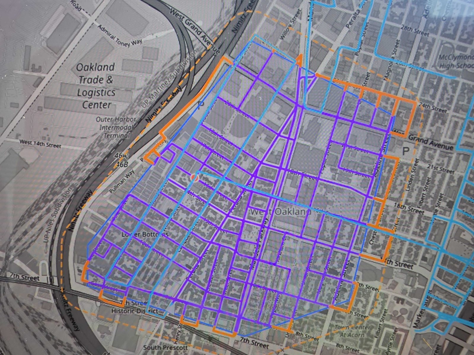
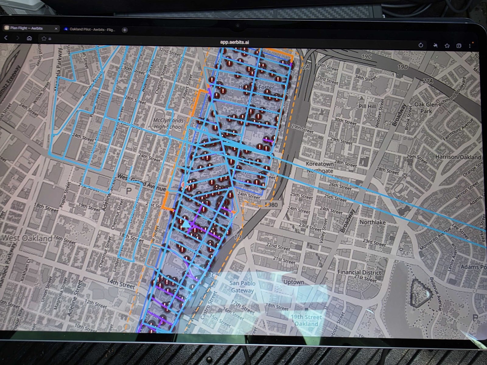
Every mission begins before we leave the driveway. We built our own flight-ops software — the platform we use to plan every mission — to plan exactly where the drone will fly. That means laying survey grids over the streets we need to cover, plotting flight legs, and checking airspace before a single rotor turns.
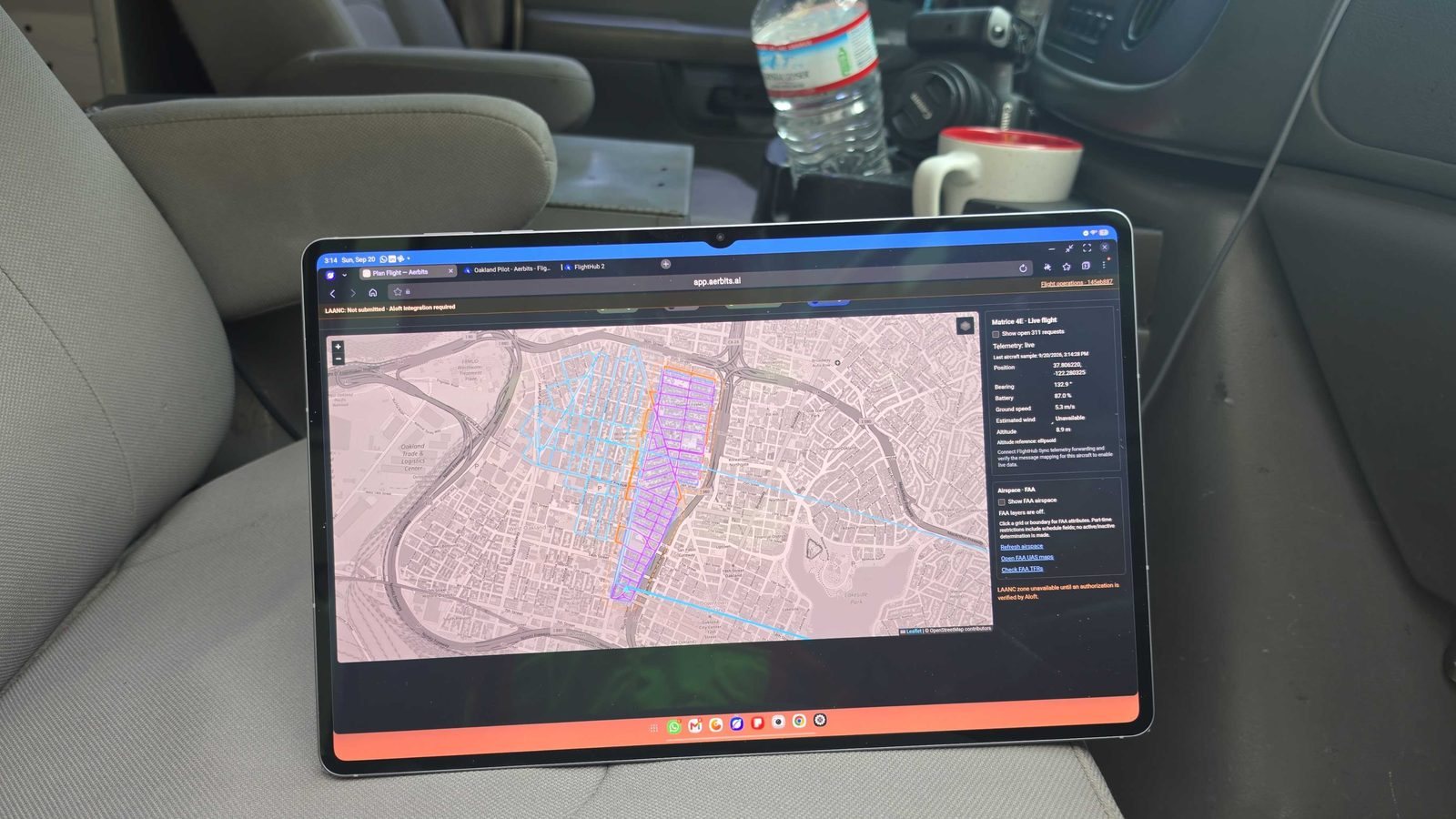
Off-the-shelf mapping tools weren’t built for the question we’re answering — “find every dumpsite on every block of a corridor.” So we wrote our own. The software lets us define coverage areas, lay down repeatable grids, and pull in the FAA airspace picture so every flight is planned against what’s actually above the neighborhood.
The Bucket Van: How We Keep Eyes on the Drone
Here’s the part people don’t expect. We fly under visual line of sight (VLOS) — which means someone has to be able to see the aircraft with their own eyes for the entire flight. In dense urban blocks, standing on the sidewalk isn’t enough: buildings, trees, and street furniture put the drone out of sight within seconds.
So we operate from a bucket van. We elevate the visual observer above the roofline, and from that perch the drone stays in sight for the whole route. It’s a simple, robust answer to one of the hardest practical problems in urban drone operations — and it lets us fly legally and safely over exactly the corridors that need coverage.
The setup is deliberately compact, so we don’t disrupt the block we’re working. The boom never reaches beyond the van’s own footprint — the bucket goes straight up, staying directly above the vehicle and inside the space it already occupies. There are no outriggers to unfold and no footprint beyond the van itself, and the van fits in a normal curbside parking spot. We’re never parked there long, either: each stop is capped at 45 minutes, then we move on.
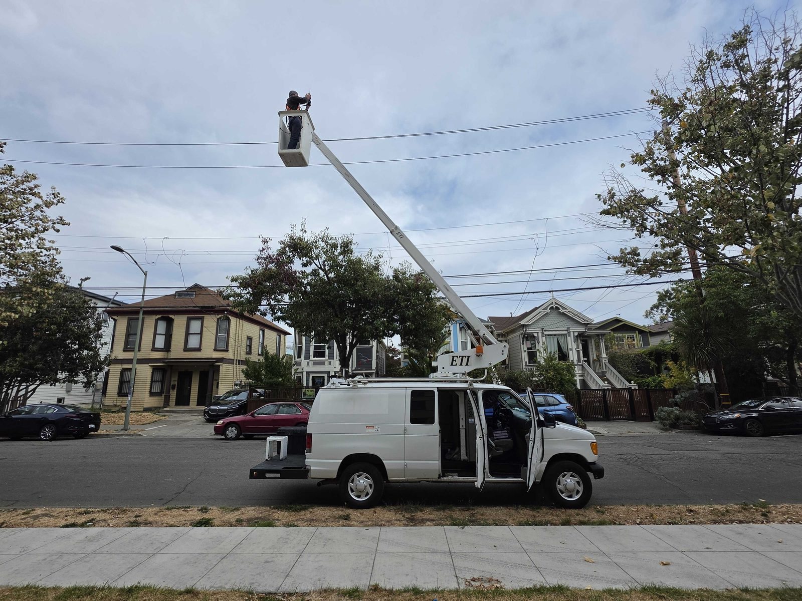
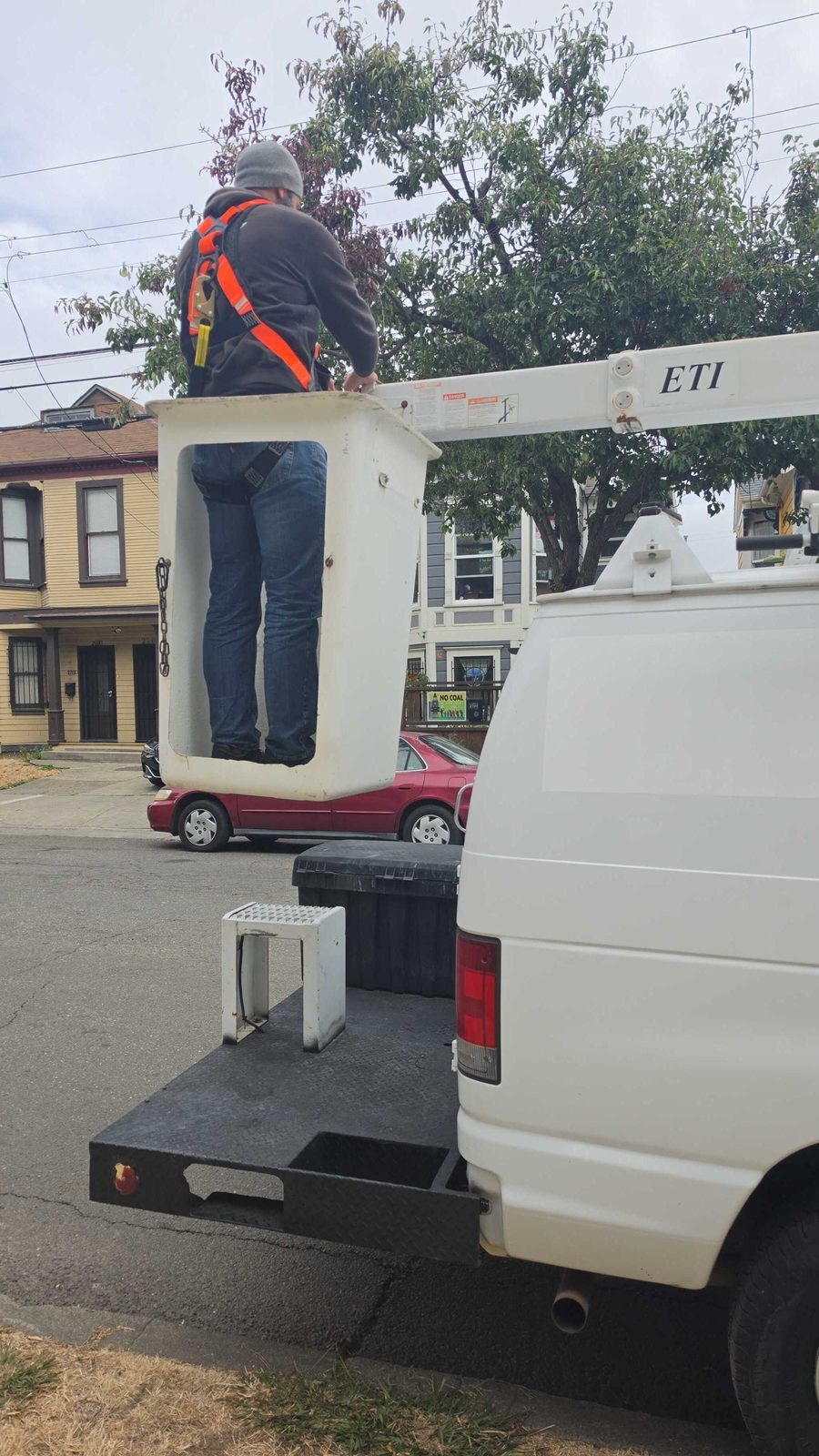
The drone flies a planned grid while the observer tracks it from above. No BVLOS waiver, no guesswork — just a clean, compliant setup that lets the aircraft do its job while a human keeps eyes on it the whole way.
Flying Over People and Moving Traffic, Compliantly
The neighborhoods we survey aren’t empty. People walk the sidewalks, cars move through the streets, and that’s a real constraint on where — and whether — a drone can fly. Our setup is built for exactly that: we fly a DJI Matrice 4E carrying an AVSS parachute recovery system — a combination that follows the FAA-accepted means of compliance for operations over people and moving vehicles, based on the ASTM F3322-24a parachute standard that the AVSS PRS-M4S is built and tested to.
The AVSS system mounts directly to the aircraft and monitors flight parameters independently of the autopilot. If it detects a critical failure, it autonomously deploys the parachute and cuts the motors — bringing the aircraft down at a rate slow enough that, even in the worst case, the energy at impact stays within the bounds the FAA defined for operations over people. That’s the difference between a drone that can only fly over empty streets and one that can map a busy commercial corridor at midday.
No street closures, no waiting for traffic to clear, no restricted flight windows. The parachute is the safety net, the pilot-in-the-loop is the operator, and together they let us cover the corridors where dumping actually happens.
Custom AI That Detects Garbage
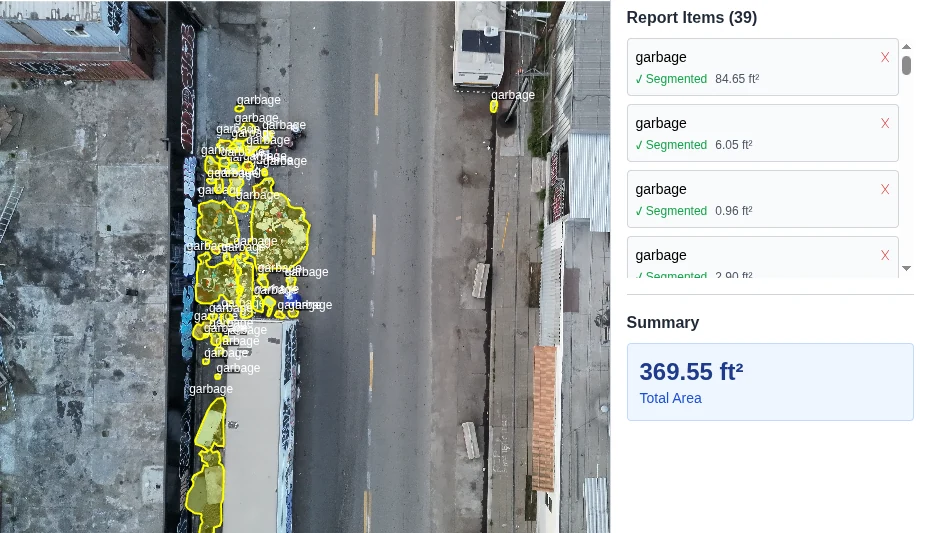
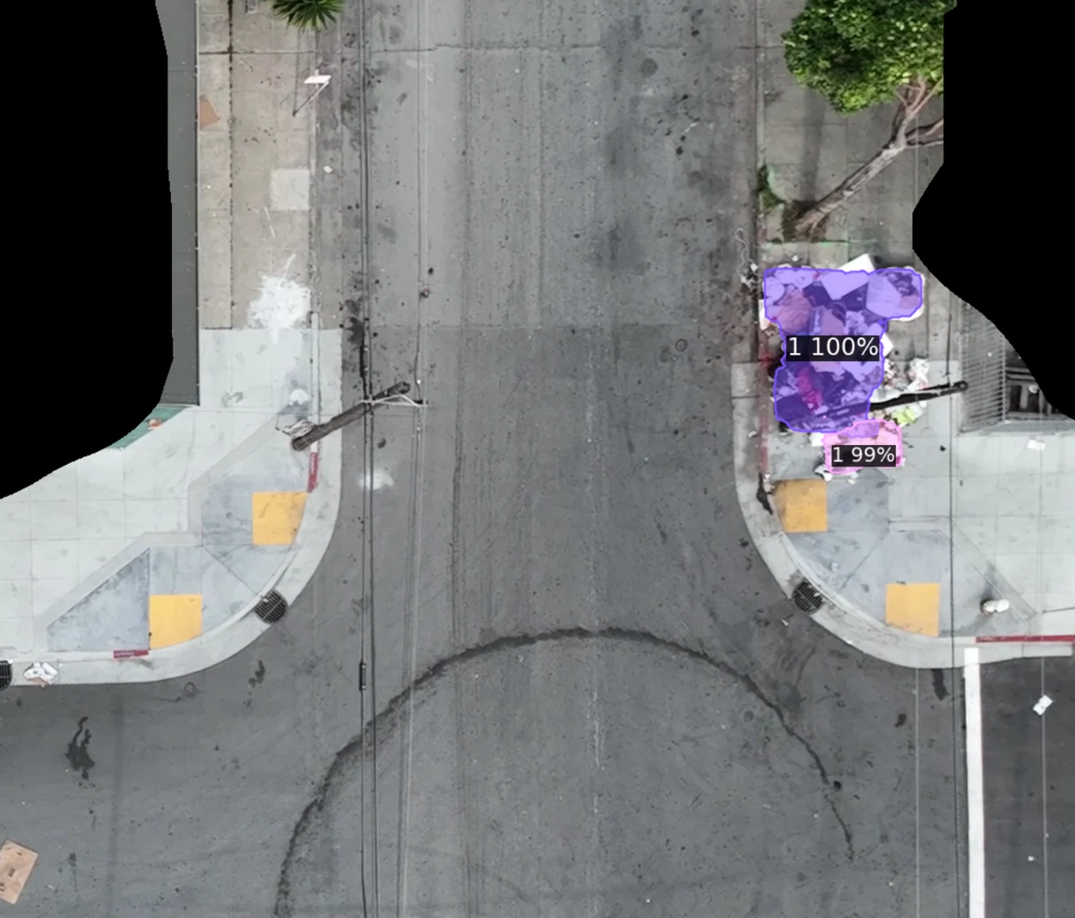
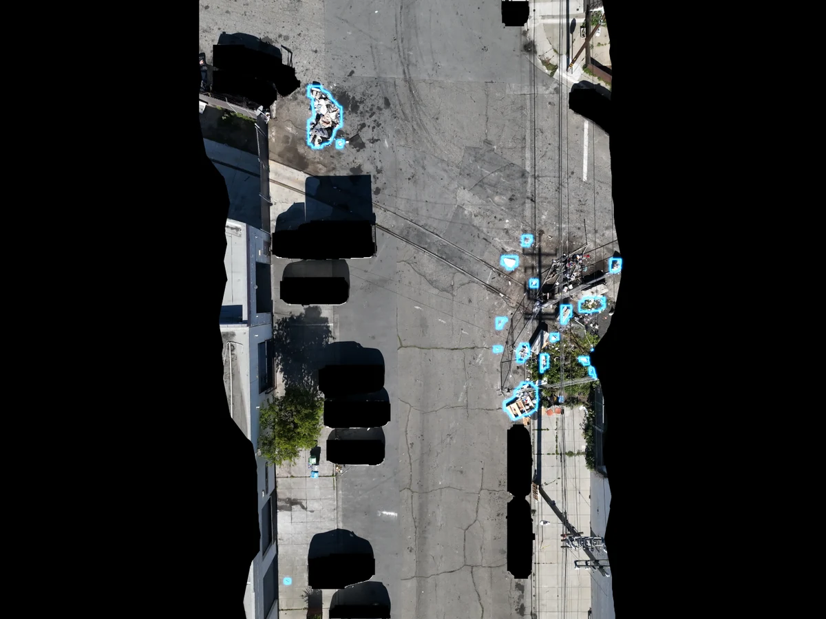
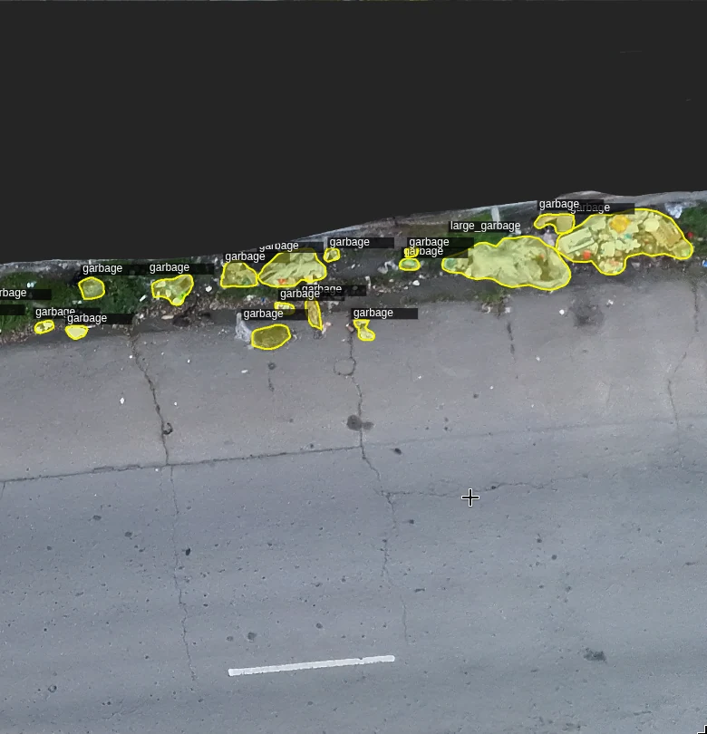
As the drone flies, it captures nadir imagery — straight-down frames of every street beneath the route. Each frame is processed by our own detection model, a mixture-of-experts (MoE) architecture we built and trained in-house. It isn’t an off-the-shelf model; it was trained on the dumpsites we’ve mapped across hundreds of flights, so it knows what a construction pile looks like from 125 feet, and what a mattress in a doorway looks like, and what a fresh bag-dump looks like before it grows.
The model doesn’t just say “there’s something here.” It classifies what’s on the ground — furniture, construction debris, tires, appliances, hazardous material, bagged waste — and estimates the footprint of each pile. That detail is what turns a vague complaint into an actionable work order.
Here’s what that looks like from the model’s perspective — the same frames a reviewer sees when a detection comes in:
Projecting Detections Onto a Map
A detection in a photo is only useful if it has a location. So the next piece of our stack is custom software that projects every detection from the image onto a real map — ground-projected to a precise point with coordinates, an address, a size in square meters, and a category. The result is a live map of dumpsites, not a folder of photos.
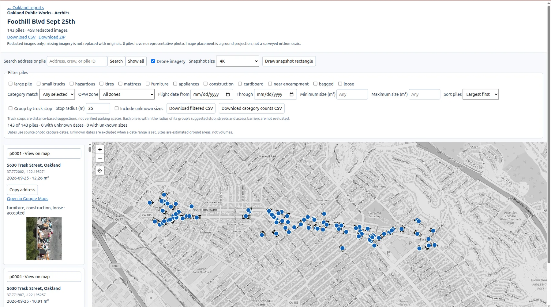
Because the aircraft flies with RTK/PPK-grade positioning, those pins are accurate to centimeters — meaning crews can drive to an exact spot instead of “somewhere on the block.” And because the imagery is redacted before it’s shared, the city gets the ground truth without the privacy exposure.
Handing the City the Ground Truth
The last step is where it becomes a public works tool. We integrate with the city’s existing work order system, matching our detections against the requests already in the queue and updating them with what we can actually see from the air. Each work order gets a disposition — cleaned, correct, or needs update — backed by drone snapshots and detection photos.
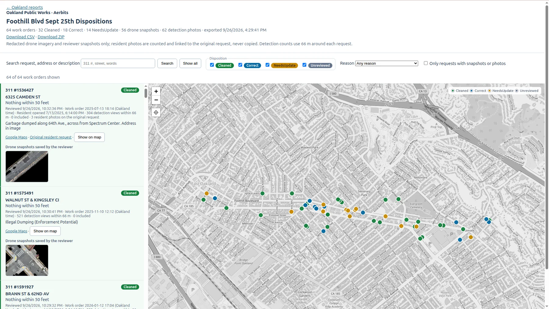
That integration is the difference between a flyover and a system. The city doesn’t get a report they have to manually reconcile — it gets its own work order system updated with the ground truth, so supervisors and crews see exactly what’s there, and what isn’t.
The Whole Loop, In Numbers
Here’s what that looked like on a single corridor survey — Foothill Boulevard, September 25:
Custom software lays survey grids and checks airspace before the flight.
A bucket van keeps the observer above the roofline, maintaining VLOS for the whole route.
Our in-house MoE model flags dumpsites in nadir imagery and classifies what’s there.
Custom software projects each detection onto a map with centimeter-level accuracy.
Detections reconcile against the city’s work order system, updating it with the ground truth.
Want to see how this would run in your city? Get in touch — we’ll walk you through a mission start to finish.